


DOUGLAS RURAL Voting District, Converse County, Wyoming
About
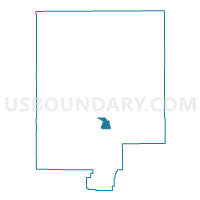
Outline

Summary
| Unique Area Identifier | 698559 |
| Name | DOUGLAS RURAL Voting District |
| County | Converse County |
| State | Wyoming |
| Area (square miles) | 15.87 |
| Land Area (square miles) | 15.84 |
| Water Area (square miles) | 0.03 |
| % of Land Area | 99.81 |
| % of Water Area | 0.19 |
| Latitude of the Internal Point | 42.74681570 |
| Longtitude of the Internal Point | -105.45015660 |
Maps


Graphs
Select a template below for downloading or customizing gragh for DOUGLAS RURAL Voting District, Converse County, Wyoming


Neighbors
Neighoring Voting District (by Name) Neighboring Voting District on the Map
- DOUGLAS SOUTHWEST Voting District, Converse County, WY
- GUTHRIE Voting District, Converse County, WY
- LA PRELE Voting District, Converse County, WY
- ORIN Voting District, Converse County, WY